


COUNCIL BLUFFS PCT 18, Pottawattamie County, Iowa
About
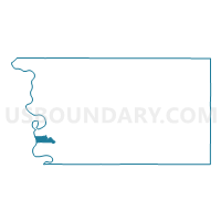
Outline

Summary
| Unique Area Identifier | 583275 |
| Name | COUNCIL BLUFFS PCT 18 |
| County | Pottawattamie County |
| State | Iowa |
| Area (square miles) | 4.38 |
| Land Area (square miles) | 4.28 |
| Water Area (square miles) | 0.10 |
| % of Land Area | 97.65 |
| % of Water Area | 2.35 |
| Latitude of the Internal Point | 41.24191740 |
| Longtitude of the Internal Point | -95.88351030 |
Maps


Graphs
Select a template below for downloading or customizing gragh for COUNCIL BLUFFS PCT 18, Pottawattamie County, Iowa


Neighbors
Neighoring Voting District (by Name) Neighboring Voting District on the Map
- COUNCIL BLUFFS PCT 12, Pottawattamie County, IA
- COUNCIL BLUFFS PCT 14, Pottawattamie County, IA
- COUNCIL BLUFFS PCT 15, Pottawattamie County, IA
- COUNCIL BLUFFS PCT 17, Pottawattamie County, IA
- COUNCIL BLUFFS PCT 19, Pottawattamie County, IA
- COUNCIL BLUFFS PCT 20, Pottawattamie County, IA
- Precinct 3-24, Douglas County, NE
- Precinct 4-4, Douglas County, NE
- Precinct 4-8, Douglas County, NE
Top 10 Neighboring County Subdivision (by Population) Neighboring County Subdivision on the Map
- Omaha city, Douglas County, NE (408,958)
- Kane township, Pottawattamie County, IA (53,485)
- Lewis township, Pottawattamie County, IA (12,954)
Top 10 Neighboring Place (by Population) Neighboring Place on the Map
Top 10 Neighboring Unified School District (by Population) Neighboring Unified School District on the Map
- Omaha Public Schools, NE (346,311)
- Council Bluffs Community School District, IA (59,804)
- Lewis Central Community School District, IA (15,299)
Top 10 Neighboring State Legislative District Lower Chamber (by Population) Neighboring State Legislative District Lower Chamber on the Map
Top 10 Neighboring State Legislative District Upper Chamber (by Population) Neighboring State Legislative District Upper Chamber on the Map
Top 10 Neighboring 111th Congressional District (by Population) Neighboring 111th Congressional District on the Map
Top 10 Neighboring Census Tract (by Population) Neighboring Census Tract on the Map
- Census Tract 18, Douglas County, NE (3,970)
- Census Tract 314, Pottawattamie County, IA (3,783)
- Census Tract 308, Pottawattamie County, IA (3,491)
- Census Tract 312, Pottawattamie County, IA (3,180)
- Census Tract 304.02, Pottawattamie County, IA (2,763)
- Census Tract 306.02, Pottawattamie County, IA (2,741)
- Census Tract 313, Pottawattamie County, IA (2,580)
- Census Tract 25, Douglas County, NE (2,557)
- Census Tract 23, Douglas County, NE (2,454)
- Census Tract 310, Pottawattamie County, IA (2,341)